Natural Parks
Springfield Greenway
A shaded paved trail linking Garner Park, the community center and the creek — the walk locals actually do on Sundays.
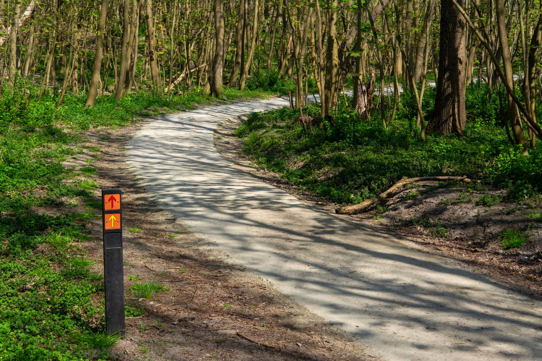
A shaded paved trail linking Garner Park, the community center and the creek — the walk locals actually do on Sundays.
The Springfield Greenway is the walking spine of the town — a paved, mostly-flat 2.6-mile ribbon connecting Garner Park on 5th Avenue West with the J. Travis Price Park trail network and the Robertson County Community Center. It is the honest answer to 'what do people do here on a Sunday morning', and it costs nothing. Strollers, wheelchairs and beginner cyclists all handle it fine; the surface is smooth and the grade never bites.
The nicest stretch is between Garner Park and the little wooden footbridge over Sulphur Fork Creek — dogwoods flower in April, the creek runs clear after rain and there are half a dozen benches spaced along the water. Past the bridge the trail climbs gently to the community center, where there are restrooms, a water fountain and a snack machine that works most days. Locals loop it end-to-end for a 5-mile round trip; casual visitors do the creek stretch out-and-back in under an hour.
Best time is early morning or the hour before sunset — the middle of a July afternoon is brutal with no shade on the community-center stretch. Park free at Garner Park (5th Ave W) for the prettiest start, or at the community center lot if you want restrooms first. It links directly to J. Travis Price Park, so you can chain them for a half-day of walking without moving your car.
Walked west to east, the trail opens with the easiest quarter-mile in Robertson County: flat asphalt around the Garner Park pond, playground equipment on your right, ducks that will absolutely follow a family carrying bread. After the pond the path narrows between mown grass and the back fences of 5th Avenue houses — this is small-town greenway, not wilderness, and the honesty of that is half its charm. Around the half-mile mark the tree cover thickens and the noise drops off as the route bends down toward Sulphur Fork Creek. The last few hundred yards before the footbridge are the reason people come: shade, water sound, benches facing the current. If you are walking with a toddler or anyone who tires, make the footbridge your turnaround point and treat the eastern half as a separate outing on another day.
Planning it takes about ninety seconds. Bring a filled water bottle — the only drinking fountain is at the community center end, so the western two-thirds of the trail has nothing, and in August that matters more than it sounds. Trainers are enough; no boots, no poles, no map. Dogs are welcome on a leash and there is no permit or check-in of any kind. There is no bike hire anywhere in Springfield, so cyclists need to arrive with their own machine on the car. Do not plan a loop: the greenway is a linear out-and-back, and attempts to close it by walking back along Memorial Boulevard put you on a fast road with no sidewalk for part of the way. Decide your turnaround before you start — footbridge for 40 minutes, community center for a full two hours — and you will not overreach.
Getting here means driving, full stop. Robertson County has no public bus network and Nashville's WeGo services stop well short of the town, so there is no line number and no fare to quote. From the courthouse square in downtown Springfield, Garner Park is a four-minute drive west on 5th Avenue West or a 15-20 minute walk if you are staying near Main Street. From Nashville, take I-65 north to exit 112 and head west on TN-76 for about 11 miles, roughly 45 minutes door to door; the alternative run straight up US-431 through Joelton is prettier and about the same time. From White House it is a 20-minute drive west on TN-76. Both trailhead lots are free and unmarked-easy: Garner Park on 5th Avenue West, and the Robertson County Community Center lot at the eastern end. Park at Garner Park unless you need restrooms first.
What it costs is the shortest section on this page: $0. There is no entry fee, no parking charge, no bike fee, no permit for leashed dogs, no guided walk to be upsold on. The only money that changes hands is at the snack machine by the community center, which wants small bills and quarters — carry $2 if you want a cold drink at the turnaround, and do not rely on it. Petrol from central Nashville and back runs roughly $8-10 in a normal car. Coffee on the downtown square before you start is a few dollars. If you are basing yourself in town, the Hampton Inn by Hilton Springfield and the Holiday Inn Express & Suites Nashville North Springfield by IHG are both a short drive from the 5th Avenue West trailhead, which makes an early-morning walk before checkout genuinely easy. Budget nothing and you will still have change.
Timing matters more than any other decision here. Between 6:00 and 8:00 the trail belongs to dog walkers and a handful of runners and you may have the creek benches entirely to yourself. From about 8:30 to 10:30 on Saturday and Sunday it is at its busiest — strollers, three-abreast conversations, the occasional cross-country group — still pleasant, never crowded. Middle of the day from June through August is the one window to avoid outright: Middle Tennessee humidity pushes the heat index past 95F and the eastern half offers no relief. Evenings from 17:00 to sunset are the second-best slot, though mosquitoes gather near the water after dusk. By month: late March through May is the peak, with redbuds and April dogwoods; September to early November is the most reliable weather of the year; winter is empty and clear but the footbridge planks turn slick after freezing rain.
It suits some people superbly and bores others in twenty minutes. Wheelchair users and stroller-pushers get one of the few genuinely smooth, kerb-free surfaces in the county. Runners get a measured 5-mile round trip without traffic lights. Families with small children get a pond, a playground and a bridge inside the first mile. Older walkers get benches at sensible intervals. Teenagers expecting anything to happen will be finished quickly, and serious cyclists will find 2.6 miles too short to count as a ride unless they chain it into the J. Travis Price Park trails. Skip it entirely on a wet afternoon — there is no shelter anywhere along the route and the creek section holds puddles for a day after rain. If you have a single free hour in Springfield, walk Garner Park to the footbridge and back and leave the eastern half alone.
For the rest of the half-day, the obvious pairing is J. Travis Price Park, which the greenway feeds directly into and which adds woodland trails, a disc golf course, playgrounds and ball fields — enough to stretch a morning walk into three hours without moving the car. Downtown Springfield is about a mile east of the Garner Park trailhead: 15-20 minutes on foot or four minutes by car, and the square around the Robertson County Courthouse holds the town's coffee, lunch and antique shopping in a couple of blocks. The Robertson County Fairgrounds sit a short drive north. Further out, White House is 20 minutes east for chain dining and the I-65 corridor hotels, and downtown Nashville is around 45 minutes south. Do the greenway early, eat on the square, and keep the afternoon for Price Park if the weather holds.
The honest caveats. Two point six miles is short — visitors arriving from a city with a proper trail network will finish it and wonder if they missed something; they did not. The shade the trail is known for is concentrated in the creek section, and the stretch approaching the community center is fully exposed. Traffic noise carries in from the nearby roads for parts of the route, and the backs of houses and industrial buildings are visible more often than photographs suggest. Sulphur Fork Creek runs muddy for a day or two after heavy rain and low sections can be closed for storm cleanup with no warning online. Restrooms exist at one end only and follow the community center's own opening hours, not the trail's. Signage is minimal and there are no rangers. Do not drive up from Nashville solely for this; walk it because you are already in Springfield.
Always free · Open sunrise to sunset
Mon-Sun 6:00-21:00
Sulphur Fork Creek footbridge — Midpoint of the greenway, roughly 1.1 miles from the Garner Park trailhead
Garner Park trailhead & duck pond — West end of the greenway, 5th Avenue West entrance
Community Center connector — East terminus behind the Robertson County Community Center on Bill Jones Industrial Drive
Start at Garner Park — the parking is easier and the pond stretch is the prettiest part.
Go before 9am in summer; there's almost no shade on the eastern half.
Restrooms only at the community center end — plan accordingly.
It is completely free, all day, every day. There is no entry fee, no parking charge at either trailhead, no permit for cycling and no charge for leashed dogs. The only money you might spend on site is $2 in small bills at the snack machine near the Robertson County Community Center, and it does not always cooperate. Fuel from central Nashville and back is roughly $8-10. Bring a filled water bottle rather than counting on buying one — there is nothing to buy along the trail itself.
Always free. There is no ticket booth and no fee for parking at either trailhead. That applies year-round, weekends and holidays included, at both the Garner Park lot on 5th Avenue West and the community center lot at the eastern end. Nobody checks anything, there is no honesty box and no seasonal charge. The one practical restriction is daylight: the trail is intended for use between sunrise and sunset, which in December means it is effectively unusable after about 16:30.
One to two hours for the full out-and-back; 40 minutes if you only walk the creek section. The full 2.6 miles each way works out at around 5 miles round trip, which most walkers cover in about two hours at a conversational pace, or 45-50 minutes running. Garner Park to the Sulphur Fork Creek footbridge and back is 2.2 miles and the best use of a short window. Add another two hours if you continue into the J. Travis Price Park trail network from the eastern end.
Officially open sunrise to sunset year-round; portions may close briefly after heavy storms for cleanup. Sulphur Fork Creek rises fast after prolonged rain and the low ground near the footbridge is the first part to be affected, sometimes for a day or two. Ice storms make the bridge planks genuinely slippery in January and February. There is no seasonal closure and no weekly closed day, but the community center restrooms follow the building's own hours, so an early Sunday walk may find them locked.
No — just show up. No permits needed even for cycling or leashed dogs. There is no ticket system, no timed entry, no visitor center and nobody to check in with. Groups do not need to notify anyone either, though a large party is easier on everyone if it starts from the community center lot rather than the smaller Garner Park end. If you want a bike, note that Springfield has no rental outlet, so bring your own on the car — that is the only advance arrangement this trail ever requires.
Free lots at Garner Park (5th Ave W) or the Robertson County Community Center. There is no public transit in Robertson County — WeGo buses do not run this far north of Nashville — so arriving by car is the only realistic option. Garner Park is the better start: easier turning, closer to the pond and the shaded creek section. From the courthouse square downtown it is a four-minute drive or a 15-20 minute walk. From I-65, take exit 112 and head west on TN-76 for about 11 miles.
Every booking through Springfield Destinations funds one verified tonne of carbon removal — same room, same price, no markup.
Find a stay