Trails Hiking
Red River Greenway
A quieter, wilder trail along the Red River — the county's best chance to see beaver, kingfishers and heron.
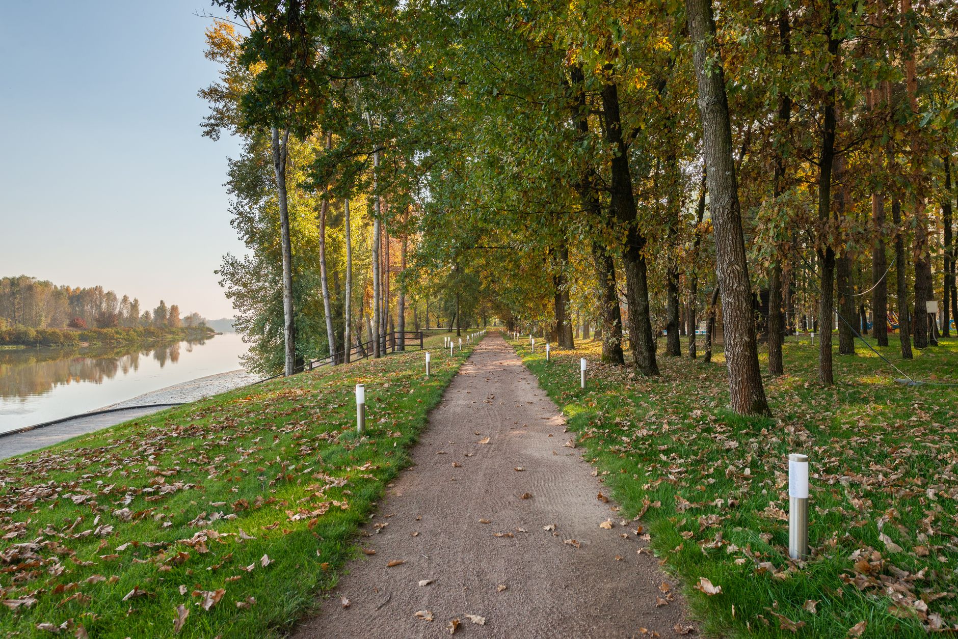
A quieter, wilder trail along the Red River — the county's best chance to see beaver, kingfishers and heron.
The Red River is the working river of Robertson County — it drains most of the county's tobacco land westward towards the Cumberland at Clarksville, and its wooded corridor holds the best wildlife in the region. The Red River Greenway, a growing network of trail segments developed piecemeal by the county and volunteer groups, gives you honest access. The main established section runs about 2.4 miles along the north bank between Adams and the Port Royal boundary — flat, well-signed, alternately shaded woodland and open river bluff.
It is quieter than the Springfield Greenway and correspondingly better for wildlife. Expect belted kingfishers rattling above the water, green herons stalking the shallows, and, at dawn or dusk, real chances at beaver, mink and the occasional river otter. Wildflowers in April, cardinal flowers in August. The trail surface is packed gravel — fine for hybrid bikes, tough for road bikes and strollers. There are two small pull-off overlooks with benches, and one wooden observation platform above a slow bend. Bank fishing is legal with a Tennessee licence, and the deeper bends hold smallmouth bass, redhorse and channel catfish; wood ducks flush off the quiet water almost every morning between October and March.
Come early or late — midday in summer is hot and the horseflies find you. Winter is genuinely lovely with the leaves down and the river visible for the whole walk. Park at the Highway 41 trailhead north of Adams; there's a second smaller lot at the Port Royal end but it fills up on weekends. Pair with Port Royal State Historic Park to make a proper morning of it. If you only have an hour, walk out to the observation platform at 1.3 miles and turn back — that is the single best stretch, and it spares you the return leg across the open bluff, which is the hottest and least interesting part of the whole trail.
There is no bus. Robertson County has no fixed-route transit, Nashville's WeGo network stops well short of Springfield, and the demand-response service that does operate in the county is not built for dropping walkers at a rural trailhead. Drive. From the courthouse square in Springfield, take Memorial Boulevard onto US-41 and run northwest through Cedar Hill to Adams — about nine miles, fifteen to twenty minutes — then continue a short distance north on the same road to the gravel trailhead lot on the river side. TN-76 out of Springfield reaches Adams just as quickly and is the better route if you are coming back through Port Royal afterwards. From downtown Nashville allow around 45 minutes and 40 miles. Guests at the Hampton Inn by Hilton Springfield or the Holiday Inn Express & Suites Nashville North Springfield by IHG are both roughly 20 minutes from the parking area.
Nothing here costs money. There is no gate, no ticket booth, no parking meter and no donation box, and there is also no vending machine, no drinking fountain and no restroom at the Highway 41 lot — the nearest toilets are at Port Royal State Historic Park, which is also free. Budget instead for the things a river-bottom walk actually needs: insect repellent at $6 to $8 a can, water you carry in, and fuel for a 20-mile round trip from Springfield. Fishing is the one activity that carries a fee, through a Tennessee Wildlife Resources Agency licence — roughly $11 for a one-day permit and around $34 for a resident annual, with non-resident short-term permits in the region of $40; buy online or over the counter in Springfield before you drive out. Skip the idea of buying lunch in Adams — the choice is a gas-station counter — and eat on the square in Springfield instead, where a sit-down plate runs $12 to $18.
Time of day matters more here than anywhere else in the county. The window is 6:30 to 8:30 in the morning: kingfishers working the bends, herons still in the shallows, beaver sign fresh on the bank, and cool air in the bottomland before the sun clears the trees. A second, weaker window opens after 17:00. Between roughly 11:00 and 16:00 in July and August it is 90 degrees, still, and thick with horseflies, and you will see almost nothing. By month: late March into April for bluebells and trillium and the first migrants; May for warblers in the wet woods; August for cardinal flower on the mud banks; late October into early November for colour; and December through February for the clearest views, when the leaves are down and the whole river is visible from the trail. February and March are also the flood months. A winter weekday morning gives you the place to yourself.
It suits birders, dog walkers with a leash, trail runners, gravel and hybrid cyclists, and families with children old enough to walk four or five miles without complaint. It does not suit wheelchair users — the surface is loose packed gravel with no hard-paved section and no accessible restroom anywhere on the corridor — and an umbrella stroller will fight you the whole way. Skip it entirely if you have a one-hour gap: the drive alone is 40 minutes round trip from Springfield, and the paved Springfield Greenway in town does the same job for a short walk. Skip it on a wet afternoon too; there is no shelter of any kind between the two lots. Teenagers tend to find it dull unless you hand them binoculars or a rod, in which case the slow bend below the platform will hold them for an hour.
Fold it into a half-day with Port Royal State Historic Park, at the west end of the trail near Adams — free, open from 8:00 to sunset, with picnic shelters, restrooms, canoe access to the Red River, the rebuilt covered bridge over the water, and a certified site on the Trail of Tears National Historic Trail. It is a ten-minute drive from the Highway 41 lot if you would rather not walk both ways. Adams itself takes fifteen minutes to see: the old Bell School building housing the local museum keeps short and seasonal hours, so call before you count on it. Bell Witch Cave, on the edge of the village, runs guided tours for around $20 an adult on a seasonal schedule and books out through October — reserve ahead or leave it. Then drive the 20 minutes back to the Springfield square for lunch. Clarksville is 25 to 30 minutes west if you want a bigger afternoon.
The word greenway oversells it. This is not a continuous paved loop like the one in town; it is one solid 2.4-mile spine plus fragments, the connections between segments are thin on signage, and some links drawn on older county maps have never been built on the ground. Do not set out expecting to walk from Adams to Clarksville. River otter is the headline animal and most visitors never see one — treat a sighting as luck, not an itinerary. The other honest warnings: ticks and chiggers from April to October, so check yourself in the car; copperheads in the leaf litter on the bluff section; private posted land immediately off the corridor, so stay on the tread; deer season on adjacent ground in late November, when blaze orange is sensible; and floodwater that puts the low sections under for days at a time after a hard winter rain. The river is not for swimming — muddy bottom, submerged snags, no supervision.
Always free · Open sunrise to sunset
Mon-Sun 6:00-20:00
Wooden observation platform — Roughly 1.3 miles from the Adams trailhead, above the river bend
Cypress slough boardwalk — 0.6 miles from the Adams trailhead, on the wet-woods spur
Port Royal river overlook — West end of the trail near the state historic park boundary
Early morning is best for wildlife — kingfishers and heron are most active before 8am.
Bring bug spray May through September; the river bottom breeds mosquitoes.
Skip after heavy rain — sections can flood for a day or two.
Free — no entry fee, no parking fee. There is no gate, no ranger station and nobody to pay: the corridor is county land maintained largely by volunteers, and both lots are open gravel. The only money a visit takes is fuel for the 20-mile round trip from Springfield and a can of repellent at $6 to $8 between May and September. Bank fishing is the single exception, because a Tennessee licence is required. There is no concession stand, no water fountain and no trash service, so carry water in and your rubbish out.
Every day, sunrise to sunset. The posted window is 6:00 to 20:00, but the practical limit is daylight — in late December that means being back at the car by about 16:45, and in June you can still be walking at 20:00. Nothing changes on weekends or holidays, and there is no paid evening or early-morning access to buy. The one thing worth knowing is that the Port Royal lot at the west end fills on fine Saturday and Sunday mornings; arrive before 9:00 or start from the Highway 41 trailhead instead.
Two to three hours for the round trip; longer if you're birding. The main section is 2.4 miles each way, so 4.8 miles out and back — around two hours at a walking pace with stops at the two benches and the platform. On a hybrid bike it is closer to an hour. Birders working the cypress slough spur and the slow bend should budget three to four hours and start at first light. If you are short on time, the 2.6-mile out-and-back to the observation platform takes about 75 minutes and gives you the best of it.
No scheduled closures. Sections may close briefly after major flooding. The Red River rises fast, and after a heavy winter or spring rain the low ground near the slough can sit under water for a day or two — February and March are the usual months. Check the river level at Port Royal before driving out if it has rained hard in the previous 48 hours. Ice storms and summer thunderstorms also bring limbs down across the tread, which volunteers usually clear within a few days. There is no seasonal shutdown and no maintenance closure day.
No permits for walking or cycling. Fishing needs a state license. Buy a Tennessee Wildlife Resources Agency licence online or over the counter in Springfield before you go: roughly $11 for a one-day permit, around $34 for a resident annual, and about $40 for a short-term non-resident permit. Resident children under 13 fish free. Paddling the Red River needs no permit either, though the practical launch is the canoe access at Port Royal State Historic Park rather than anywhere on the greenway itself. Dogs are fine on a leash.
By car — trailhead is on Highway 41 north of Adams, about 20 minutes from Springfield. There is no bus: Robertson County runs no fixed-route service and WeGo's Nashville network does not reach this far north. From the Springfield square take Memorial Boulevard onto US-41 northwest through Cedar Hill, about nine miles, and the gravel lot is signed on the river side just past Adams. TN-76 is an equally quick alternative. From downtown Nashville allow 45 minutes. Last fuel and snacks are in Adams; there is nothing at the trailhead itself.
Every booking through Springfield Destinations funds one verified tonne of carbon removal — same room, same price, no markup.
Find a stay