Natural Parks
Cross Plains State Natural Area
A rare cedar-glade ecosystem — thin soil, wildflowers found almost nowhere else, and total silence.
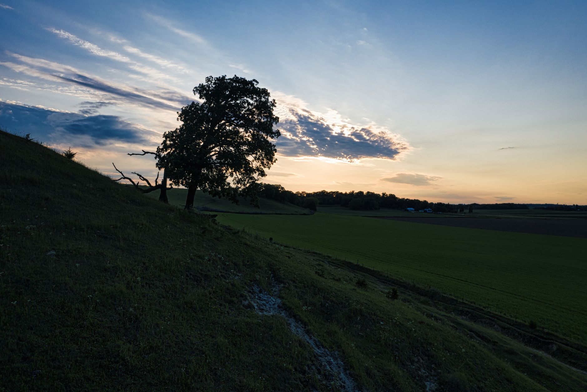
A rare cedar-glade ecosystem — thin soil, wildflowers found almost nowhere else, and total silence.
Cross Plains State Natural Area protects one of Middle Tennessee's rare limestone cedar glades — an ecosystem so specific it hosts plant species that grow essentially nowhere else on earth. The 168-acre preserve is thin soil over cedar-cracked bedrock, red cedars in the surrounds and open glade in the middle, and in April and May it explodes with Tennessee coneflower, glade cress and Nashville breadroot. The rest of the year it is a quiet, austere walk that most Tennesseans have never heard of.
There is one primary loop trail, about 1.8 miles, that leaves the small gravel lot and threads through cedars into the open glade area, then curves back through mixed woodland. It is mostly flat but the rock surface is uneven — proper shoes matter. There are no facilities, no ranger station and no signage beyond the entry board; a printed trail map from the Tennessee State Natural Areas website is worth bringing. Silence is the point — expect to hear nothing but wind and the occasional pileated woodpecker.
Peak visit is late April to mid-May for the wildflower bloom, especially the Tennessee coneflower which is only just off the federal endangered list. Go early on a weekday to have the glade to yourself; even on peak wildflower Saturdays you'll rarely see more than a handful of people. Stay on the trail — the glade plants are fragile and a single footstep destroys years of growth. Cross Plains village is 5 minutes away with the Thomas Drugs old-fashioned soda fountain worth a stop.
The walk breaks into three distinct stretches and it helps to know which one you are in. The first quarter-mile from the gravel lot is closed cedar — dark, needle-floored, cool even in July, and the only part of the loop where you will genuinely want a map because the tread braids around fallen trunks. Then the canopy stops abruptly and you are on bare grey limestone pavement, the glade proper, where the whole point of the preserve sits in ankle-high plants growing out of cracks. The return leg through mixed hardwood and cedar is the least interesting third; if you are short on time, turn around at the far edge of the glade rather than completing the circuit. Budget about 25 minutes each way to the open glade and the rest of your two hours standing still in it.
Getting here from Springfield is a straight shot east and there is no alternative to driving. From the Robertson County courthouse square, take East 10th Avenue onto Highway 25 and stay on it for roughly 10 miles — about 15 to 18 minutes — through farmland into Cross Plains village, then continue east and turn onto East Robertson Road for the small gravel pull-in. Coming from Nashville, it is I-65 north to Exit 112 and then east on Highway 25 for about 9 miles, around 40 minutes door to door. Robertson County runs no fixed-route bus service, so there is no transit option at all, and rideshare drivers rarely sit this far north — do not plan on getting a car back at dawn. Drive yourself, or do not come.
Nothing here costs money. There is no entry fee, no parking charge, no annual pass, no donation box and no gate attendant; Tennessee's state natural areas are funded to be walked into. Your entire spend for the trip is fuel — call it a 20-mile round trip from Springfield — plus whatever you eat afterwards, and a soda-fountain lunch at Thomas Drugs in Cross Plains will keep you comfortably under $15 a head. Two things do carry a cost in effort rather than dollars: collecting plants, seed or rock requires a research permit from the Division of Natural Areas, and groups larger than ten are asked to notify the office first. Skip buying a guided tour of anything — none is offered here — and put the money into a Tennessee wildflower field guide instead, which will double what you actually see.
Time of day matters more than most people expect on open bedrock. Arrive within an hour of sunrise and the glade is cool, the light is low across the rock and the birds are loud; by 11am in summer the limestone is radiating heat, the glare flattens every photograph and there is essentially no shade to retreat into. Month by month: March brings glade cress in the seepy cracks, April and May are the broad flush the preserve is known for, late June and July bring the Tennessee coneflower spikes to full colour if you want that one species at its best, August is hot and dusty and honestly grim, September and October give dry grasses and clean air, and November to February strips the sightlines open at the cost of mud. Weekdays are near-empty in every one of those months.
This suits birders, botanists, photographers and anyone who wants an hour without a single human sound. It does not suit wheelchairs or strollers — the lot is loose gravel, the tread is uneven limestone with no boardwalk, and there is nothing paved anywhere on the property. Children from about seven upwards manage the loop fine, but bring water because there is none on site, and expect teenagers to be bored senseless outside bloom season. It is a poor rainy-afternoon plan: wet limestone is genuinely slick, there is no shelter and the glade fills with shallow standing water. If you have only an hour spare, do the out-and-back to the glade edge and leave the return leg; if you have a rainy day, go to Springfield's courthouse square instead and save this for sun.
Fold it into a half-day rather than driving out for the walk alone. Thomas Drugs sits on Highway 25 in Cross Plains village, five minutes back west, and its soda fountain is the reason most people have heard of the town at all. Keep heading east on the same road and you reach Historic Wynnewood at Castalian Springs in about 25 minutes, and Bledsoe Creek State Park on Old Hickory Lake in roughly 35 — either makes a full day out of a two-hour trail. For a bed, Springfield puts you 15 minutes away at Hampton Inn by Hilton Springfield or Holiday Inn Express & Suites Nashville North Springfield by IHG, while White House is marginally closer to the trailhead with Hampton Inn White House, Comfort Inn White House and Motel 6 White House TN all within a short run of Exit 112.
Be clear about what this is not. There is no overlook, no waterfall, no picnic pavilion, no visitor centre and no restroom — the nearest toilet is a gas station in Cross Plains village. Out of bloom, a cedar glade reads to most eyes as a rocky field with scrubby plants, and people who arrive in late August expecting a spectacle leave disappointed and blame the preserve. The 168 acres also walk smaller than they sound; 1.8 miles is the whole of it. Ticks and chiggers are a real nuisance from May through September, so treat trousers and check afterwards. And the trail is faintly marked in the cedar sections, which is not charming when you are hunting for the tread in fading light — carry the printed map, and be back at the car before dusk rather than at it.
Always free · Open dawn to dusk
Daily dawn to dusk
Main glade opening — Roughly 0.6 miles from the trailhead on the loop's north arc
Tennessee coneflower stand — South edge of the main glade, marked with a small interpretive post
Cedar tunnel section — Return leg of the loop, roughly 1.2 miles in
Come in late April or early May for the peak wildflower bloom.
Stay strictly on the trail — glade soil takes decades to recover from a footprint.
Combine with Thomas Drugs in Cross Plains village for an old-fashioned soda fountain lunch.
No — state natural areas are free to visit. There is no ticket booth, no parking charge, no annual pass and no donation box anywhere on the property, and nobody will be there to take money from you even if you wanted to give it. Your only real outlay is fuel for the 20-mile round trip from Springfield and lunch afterwards, which at the Thomas Drugs soda fountain in Cross Plains village runs under $15 a head. The one caveat: collecting plants, seed or rock samples needs a research permit from the Division of Natural Areas, and that is not something you can arrange on the day.
Always, every day, sunrise to sunset. There are no paid hours, no ticketed windows and no seasonal gate closures to work around, so the only clock that matters is daylight. Practically that means being off the trail by about 4:45pm in December and by just past 8pm in late June — there is no lighting whatsoever, the cedar sections go dark early, and the tread is faint enough that hunting for it by phone torch is miserable. The best free hour of the day is the first one after sunrise, when the rock is cool and you will almost certainly have the glade alone.
Two hours for the loop with time to look at wildflowers. The 1.8-mile circuit walks in about 45 to 50 minutes if you never stop, but nobody sensible walks a cedar glade without stopping — botanists and photographers routinely spend three hours here in late April. Add roughly 35 minutes of driving round trip from Springfield on Highway 25. If you only have an hour on the ground, do the out-and-back to the glade edge, about 25 minutes each way, and skip the wooded return leg, which is the least rewarding third of the walk.
The area is open year-round but has no facilities and can be muddy after rain. There are no holiday closures, no winter shutdown and no gate that gets locked seasonally, so in practice the only thing that stops a visit is weather. Heavy rain leaves shallow water standing in the glade runnels for a day or two and turns the limestone genuinely slick, and ice on the shaded cedar stretches is worth respecting in January. Storm-dropped limbs occasionally obscure the tread in the wooded section. Give it 48 hours after a soaking and the glade drains fine.
No booking or permits. Groups over 10 should notify the state natural areas office. There is no timed entry, no ticket, no reservation system and no scheduled guided programme here — you simply drive up and walk. School and church groups are the exception worth planning: the gravel lot holds only a handful of vehicles, so carpool rather than arriving in a convoy, and call the Division of Natural Areas ahead so staff know you are coming. Any plant collecting, seed gathering or formal research requires a written permit, which takes far longer than a phone call to arrange.
Small free gravel lot on East Robertson Road east of Cross Plains village. It takes only about six to eight cars and there is no overflow, so a peak-bloom Saturday late morning can genuinely fill it — arrive early or come on a weekday. Do not park on the narrow road shoulder and do not block the gate. Satnav can be vague out here, so navigate to the coordinates 36.5478, -86.6971 rather than the street name alone. There is no restroom, water or fuel at the trailhead; the nearest of all three is back in Cross Plains village, five minutes west on Highway 25.
Every booking through Springfield Destinations funds one verified tonne of carbon removal — same room, same price, no markup.
Find a stay