Trails Hiking
Sulphur Fork Creek
The little creek that gave Springfield its water and its name — walkable, fishable, and quietly lovely.
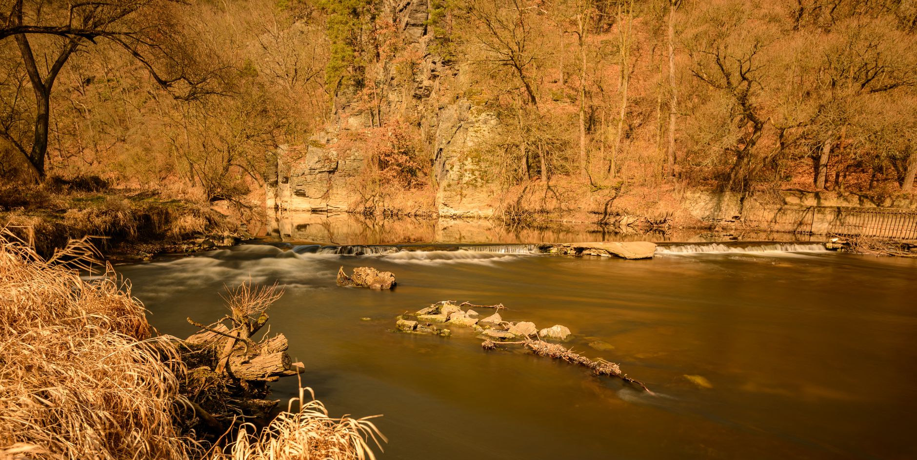
The little creek that gave Springfield its water and its name — walkable, fishable, and quietly lovely.
Sulphur Fork Creek is why Springfield exists. Early settlers built here because the creek ran clean and reliable through what was otherwise dry limestone country, and the town's original springhouses drew from its tributaries. Today the creek threads quietly through the west side of town, crossing under the Springfield Greenway on a wooden footbridge and meandering out past pastures towards the Red River. It is not a whitewater river — it is a Tennessee bottomland creek — but for a slow hour of birdwatching and stone-skipping it is perfect. Follow the water far enough downstream and it stops being a local curiosity: Sulphur Fork empties into the Red River at Port Royal, near Adams, roughly 25 minutes west of town by car, where a state historic park marks a vanished river settlement and a documented Trail of Tears crossing. Stand on the footbridge knowing that, and the creek reads as the head of a route that once carried flatboats, dark-fired tobacco and forced migration.
The easiest access is from Garner Park, where the greenway drops down to the water at the footbridge — you can scramble down and walk the gravel bar for a few hundred yards either direction. Anglers work it for bluegill, redbreast sunfish and the occasional smallmouth; you'll need a Tennessee fishing license. A second access is off North Willowbrook Drive where the creek passes under the road and there's a small wooded pullout. Both are free and neither has facilities. The greenway itself is paved and flat the whole way from the Garner Park lot, so the 1.1 miles to the bridge takes about 20 to 25 minutes at a strolling pace with a pushchair or a dog. Park at Garner rather than at the Willowbrook pullout unless you are carrying fishing tackle — the pullout holds two or three cars, has no marking, and locals use it.
Best in April-May when the dogwoods flower and the water runs clear, and in October when the sweetgums turn. Avoid after heavy rain — the creek muddies fast and the banks get slick. This is a low-key stop, not a destination unto itself; combine it with the greenway walk or a picnic at Garner Park. Bring shoes you don't mind getting wet. As a working rule: if Springfield has taken more than an inch of rain in the past 24 hours, give it two dry days before you plan to get down onto the gravel. From late June through August the shaded bends hold mosquitoes and the tall grass at the bank edge holds ticks, so long trousers and repellent turn a twitchy visit into a pleasant one. Winter is underrated here — leaves down, sightlines open, herons obvious — but the mud is at its worst.
A visit works best as a there-and-back with one clear turnaround. Start on the bridge deck itself and give it five minutes: from the planks you can see straight down into the run, which is where you spot the fish before you spook them, and it is the one viewpoint that needs no scrambling. Then take the worn path down on the downstream side and walk the gravel bar towards the shallow riffle about 100 yards along — knee-deep at most in summer, ankle-deep in a dry September. Upstream is the prettier stretch, deeper shade, undercut banks, root tangles, more likely to turn up a wood duck flushing or a belted kingfisher rattling ahead of you. Give each direction 20 minutes, then climb back to the paved path rather than trying to bushwhack around the fenced pasture edges, which are private land.
Getting here means driving; Springfield has no fixed-route city bus, and rideshare cars this far north of Nashville are thin outside peak hours. From downtown Nashville it is roughly 30 miles: north on I-65 to exit 108, then west on TN-76 for about 12 miles into Springfield, 45 to 55 minutes depending on the Rivergate stretch. The slower alternative is US-431 (Memorial Boulevard) north through Joelton, prettier and about the same in time. In town, aim for the Garner Park lot on 5th Avenue West, which is free and rarely full on weekdays; the trailhead sign is at the east end of the lot. If you are already on the courthouse square, you can walk it — roughly 10 minutes west along 5th Avenue to the park entrance, then the greenway. Decision: drive to Garner, walk the rest.
It costs nothing. There is no gate, no booth, no donation box, no parking charge at Garner Park, and no visitor centre to sell you a $10 guide you don't need. The only money the creek can extract from you is a Tennessee fishing licence if you intend to cast, bought same-day online at tnwildlife.org or over the counter at sporting-goods and farm-supply shops in town; short-term and annual tiers run from around $11 for a resident day permit up to roughly $50 for non-resident options, so check the current tier before you pay. Children under 13 fish free in Tennessee, and on Free Fishing Day — the first Saturday in June — nobody needs a licence at all, which is the cheapest possible introduction for a kid with a $15 rod from town.
Hour by hour, the first two hours after sunrise are the best of the day: the water is calm, the herons are working the shallows, and you will likely have the footbridge to yourself. Late afternoon on a Saturday is the busiest the greenway gets, though busy here means a dozen walkers and a couple of teenagers on bikes rather than a queue. Avoid the hour before dusk in winter — Springfield is on Central Time, the light is gone by about 4:45pm in December, and the greenway has no lighting. Month by month: April and May peak, October a close second, February good for birds and bad for footwear, and July and August the months to skip unless you are wading, when low clear water and heat make the creek itself the point rather than the walk.
It suits toddlers who like throwing stones, anyone with an hour to fill, and adults who would rather look at water than at a museum case. Wheelchair users and pushchairs get the paved greenway and the bridge deck, both genuinely usable; the bank scramble to the gravel bar is not accessible and there is no graded ramp anywhere along the creek, so plan the bridge as your destination. Teenagers with no interest in fishing will be done in ten minutes. Skip it altogether on a rainy afternoon — there is no shelter between the Garner Park lot and the bridge, and the clay bank turns treacherous. If you have a one-hour gap, park at Garner, walk to the bridge, look, and walk back; that is 50 minutes and it is a complete visit.
Fold it into a half-day rather than making a trip of it. The Robertson County courthouse square is a 10-minute walk east from Garner Park, with the county's brick commercial core and the archives building for anyone chasing family history. J. Travis Price Park, about 10 minutes' drive north on US-431, has a lake, dog park, disc golf and more trail than the greenway offers. Port Royal State Historic Park, 25 minutes west via TN-76 past Adams, is free and shows you the mouth of this same creek where a steel frame now outlines the lost covered bridge; Adams also has the privately run Bell Witch Cave, ticketed at the gate and seasonal, so ring ahead. The honest caveats: the so-called swimming hole is a shallow gravel-bar wade, not a swimming spot; nothing on site names or interprets the creek; there are no restrooms at the water and the nearest ones are back at Garner Park and not always open off-season; and after farm runoff following storms the water looks and smells its worst — expect a modest, pretty, working creek and you will not be disappointed.
Always free from public access points
Daylight hours
Greenway footbridge over the creek — Midpoint of the Springfield Greenway, 1.1 miles from Garner Park
Gravel bar swimming hole — 100 yards downstream of the footbridge
Willowbrook Drive creek crossing — North Willowbrook Drive, west of downtown
Go a day or two after rain — cloudy water clears fast but the level drops slower.
Wear old sneakers; the bank is muddy and slippery in the shaded stretches.
Fishing needs a state license — buy online same-day at tnwildlife.org.
No — all public access points are free. There is no ticket booth, no gate, no donation box and no charge to park at Garner Park on 5th Avenue West, which is the trailhead most visitors use. Nobody staffs the creek, so there is literally no one to pay. The only cost a visit can carry is a Tennessee fishing licence if you plan to cast, plus whatever you spend on water and a picnic downtown, since there is no cafe, kiosk or vending machine anywhere along the greenway.
Always, daylight hours. There's no gate and no ticket. In practice the limiting factor is light rather than money: the access parks follow the usual dawn-to-dusk convention and the greenway has no lighting at all, so in December, on Central Time, you want to be back at the car by about 4:45pm, while in June you can still see the water at 8:30pm. There is no evening admission, no paid night event and no seasonal ticket — the creek costs nothing in every month of the year.
One to two hours combined with the greenway; 30 minutes if you just want a look. Budget roughly 20 to 25 minutes each way for the paved 1.1 miles from Garner Park to the footbridge, five minutes on the bridge deck watching the run, and 20 minutes on the gravel bar downstream. Anglers reasonably spend two to three hours working the pools. If you are pairing it with Port Royal State Historic Park, 25 minutes' drive west, plan a half-day for the pair.
The access parks are dawn-to-dusk; the creek itself has no closure. There is no closed day of the week, no winter shutdown and no holiday gate. The realistic interruptions are weather-driven: after heavy rain the bank is unsafe and the lower greenway can hold standing water, occasional maintenance closes short sections of paved path, and hard freezes make the wooden bridge deck slick. Restrooms back at Garner Park are not guaranteed to be open off-season, so use facilities downtown before you set out.
Only if fishing — a Tennessee resident or non-resident fishing license is required. Buy it same-day at tnwildlife.org or over the counter at sporting-goods and farm-supply stores in Springfield; tiers run from around $11 for a resident day permit to roughly $50 for some non-resident options. Children under 13 fish free, and on Free Fishing Day, the first Saturday in June, no licence is needed at all. Walking, wading and picnicking need no permit, but do not cross fences into the pastures — that land is private.
Free parking at Garner Park on 5th Avenue West, then walk 1.1 miles east on the greenway. From Nashville it is about 30 miles: I-65 north to exit 108, then TN-76 west roughly 12 miles into Springfield, 45 to 55 minutes in normal traffic; US-431 north through Joelton takes about the same. Springfield has no fixed-route city bus and rideshare is unreliable here, so drive. From the courthouse square it is a 10-minute walk west to the park entrance.
Every booking through Springfield Destinations funds one verified tonne of carbon removal — same room, same price, no markup.
Find a stay